Picopolo
- Developer: GDMcom
- Home page: www.picopolo.de
- License type: Free
- Size: 58.8 MB
- Download
Review
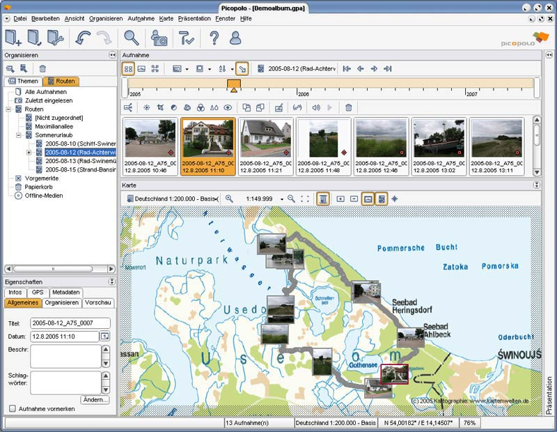
Never again forget which picture belongs to which place. Picopolo, the innovative software for travel and GPS, not only organises digital images but also links them to the exact place where they were taken and assigns them to own or provided maps. Coordinates can be allocated either manually or via direct data upload from GPS receivers. Picopolo easily integrates recorded routes or positions into the presentation and automatically computes the coordinates. Itineraries thus become vivid and traceable for the viewer. Besides this unique feature of coordinates’ assignment, Picopolo offers all the qualities you would expect in a modern photo organising tool. Images can be categorised by creating different labels, e.g. subject (holidays, wedding), route (Rally Dresden-Dakar-Banjul, Mediterranean cruise) or time (March 2006), which makes it extremely easy to search for single pictures. The same image can be added to multiple labels without creating copies. With integrated filters and functions for all common adjustment features, e.g. red eye removal, cropping, contrast and colour effects, the digital images can be edited and enhanced right away with one-click-action. Depending on individual preferences, photos can be presented and shared on web albums, as photo books, as interactive slide shows or video DVDs. Provided designs for all presentation modules also help to create individual photo albums and editions for print. For traditional photo prints, selected pictures can be uploaded to photo processing websites.