VisLog
- Category
- Utilities
- Misc Utilities
Review
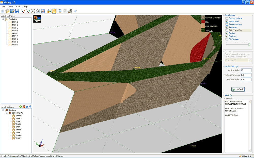
Using VisLog, the user will be able to enter borehole information including but not limited to their depth, coordinates, ground water level, etc. and have a three dimensional interactive view of the underground subject project. The ultimate aim of VisLog is to help users with making an image of the soil layers close to real condition. Input data can be taken from gINT, the most widely used borehole log software in the world. We support gINT files. Input data can be taken from gINT, the most widely used borehole log software in the world. Also user could enter data using internal test-hole editor. When the model is built upon the borehole information provided by user, the 3-dimensional model can rotate, zoom in/out, print and even saved as graphic formats. With intelligent engine of VisLog, generating soil profiles between boreholes is as easy as 1-2-3. VisLog can even be used for ground improvement projects to visualize the results. The developers of VisLog have presented a paper in GeoHalifax conference (2009) regarding a ground improvement project in Canada which was processed using VisLog.